Forestry Archaeology
By: Alexandra Burchill
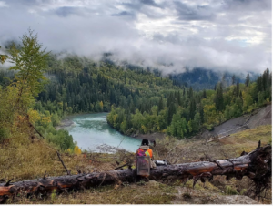
Forestry archaeology, otherwise known as the most badass type of archaeology, is as close as one can get to a lifestyle similar to Indiana Jones in 2022. Although we don’t often encounter snake pits, spike walls, or lost arks; we do encounter boreal wildlife, archaeological sites that are way older than the pyramids, and some pretty awesome views. It isn’t for the faint of heart as the work doesn’t stop in the rain and cold, and some of the locations can be very remote. I consider the last one a pro, as well as a con! The remoteness of our work areas means not very many people have been there before and you’ll often get to enjoy the untouched wilderness. You’re probably still wondering what forestry archaeology is. Below, I’ll provide some information on forestry archaeology, how it’s done, when it’s done, and what we typically find.
What is forestry archaeology?
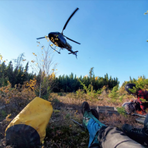
An obvious answer, but forestry archaeology refers to archaeological assessments done in the boreal forest. Since 2002, Alberta’s forest industry was required to complete Historical Resources Impact Assessments (HRIA) prior to harvesting planned blocks and building access roads. Forestry archaeology is a different ball game than other archaeological assessments in that the archaeological permits have a longer lifespan of a year, and there is more flexibility for when the permitted work can be scheduled within that time frame. Forestry projects tend to be larger and more complex logistically than other types of archaeological assessments. Often you have to plan remote access and analyze the terrain to determine whether your crews will need quads, an Argo, or even a helicopter!
Field Prep
Typically, forestry companies will send GIS development shapefiles our way in the spring, which begins the desktop assessment process. These shapefiles include the proposed harvest blocks and access roads for the upcoming year. We use LiDAR among a suite of other GIS data to determine the highest potential archaeological areas within the proposed blocks and access roads. To put it simply, LiDAR is three-dimensional imagery that allows us to assess different landforms and how elevated they are visually. For example, ever pick out an awesome camping spot in a high, dry place close to water? Those are generally the types of landforms we are looking for when we screen proposed blocks and roads.
In the Field
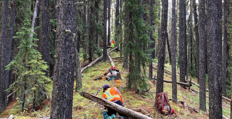
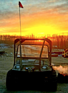
Once we have completed the desktop assessment and the governing body for archaeology in Alberta (Alberta Culture and Status of Women) has approved the permit application and the recommendations (blocks and roads get classed as either no further work or as requiring a historic resources impact assessment) the fieldwork can begin. Forestry fieldwork occurs in May through to November in Alberta and starts when the ground thaws and ends when the ground starts to freeze. Depending on the locations of different blocks and access roads, sometimes the remoteness requires crew transport by helicopter, but typical forestry assessments are done with quads. Super marshy areas will require an Argo, which is an amphibious 6*6 or 8*8 wheeled ATV.
What do we find?
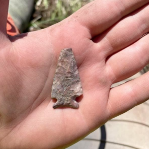
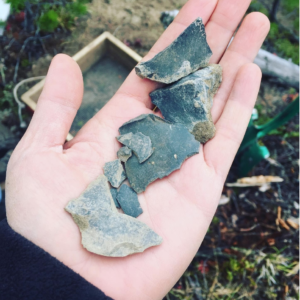
I would be lying if I said archaeology in the boreal forest is exactly what you picture when you think of the archaeology depicted in those fun History Channel documentaries. No, we do not find crystal skulls, no, we do not find Aztec ruins, annnnd no, you’re not going to find the long-lost tomb of Thutmose the II. However, we do find some kickass sites. Due to the acidic nature of soils in the boreal forest, organic material and bone do not usually survive, so what we’re left with is lithic or stone material. This includes pieces of flaked stone or stone tools. Sites in the boreal forest are usually dated by the presence of projectile points, which are diagnostic tools that have been placed within a typological sequence. Another find common in the boreal forest is historic cabins and historic sites. We shovel test around cabins as there might be buried historic material or even an archaeological site!
To sum it up, forestry archaeology is probably one of the most exciting careers out there. The work will take you to where very few people have been before, and you’ll get to experience all that the boreal forest has to offer. This includes tons of wildlife, bugs like you’ve never seen, and navigating endless muskeg fields. It also means some beautiful forests and fun but challenging quad rides. Regarding archaeology, it is somewhat predictable what you’re going to find based on which Forest Management Unit or area of the province you’re working in; however, expect the unexpected! You never know when that one shovel test on a somewhat obscure landform reveals a 12,000-year-old projectile point.
SHARE THIS:


